Texas Hill Country: Part Three

“I do not intend to tip-toe through life to arrive safely at death”

IMG_0311

Wednesday was our last day in the Hill Country.

We couldn’t ride the whole day since we were meeting a friend that evening, so we had to make the most of it.

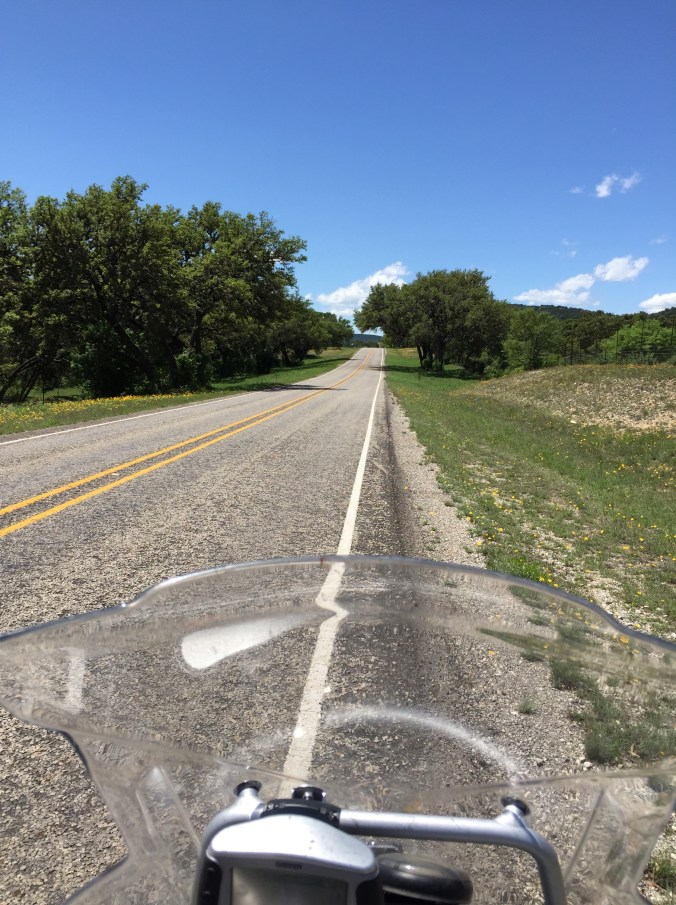
We left Junction for the last time with sunny, clear skies. After a quick Micky-D’s breakfast were off on 2169 again.

We decided to do the ride to Enchanted Rock then head to Cooper’s in Llano for lunch before moving on to Horseshoe Bay where we were staying for the night.

From 2169 we took RR 479 east to CR 470 north then north again on CR 412.

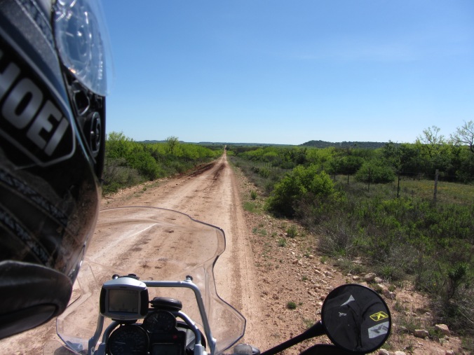
Some of these roads we had taken the day before, but going in the other direction. And with the  change in cloud cover it made for a different view of the scenery.

IMG_0248IMG_0252

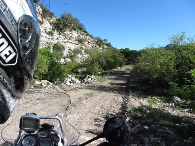
Then we took CR 410 north and east to CR 420 or  Blue Mountain Road.

IMG_0258

And yes, the cow is on THIS side of the fence. Her and all of her cow friends.

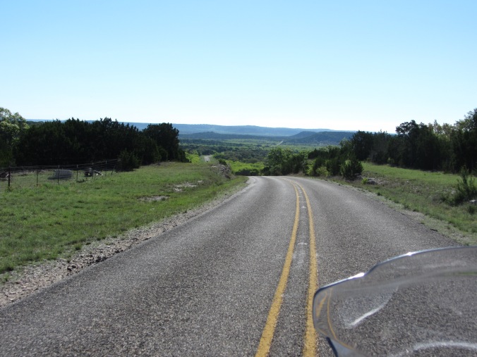
Then it was back on pavement to RR 385 southeast.

IMG_0261

And then it was our first time getting lost for the day.

We were suppose to be looking for Mill Creek Rd north. Well there’s no sign for Mill Creek Road.

We rode all the way until 385 dead ends into Hwy 290 then turned around and headed back.

After blowing up the map on the trusty (Ha!) GPS we found the road we needed to take after Mill Creek Rd and that lead us to find our way in the right direction. It turns out it was actually CR 430 according to the GPS.

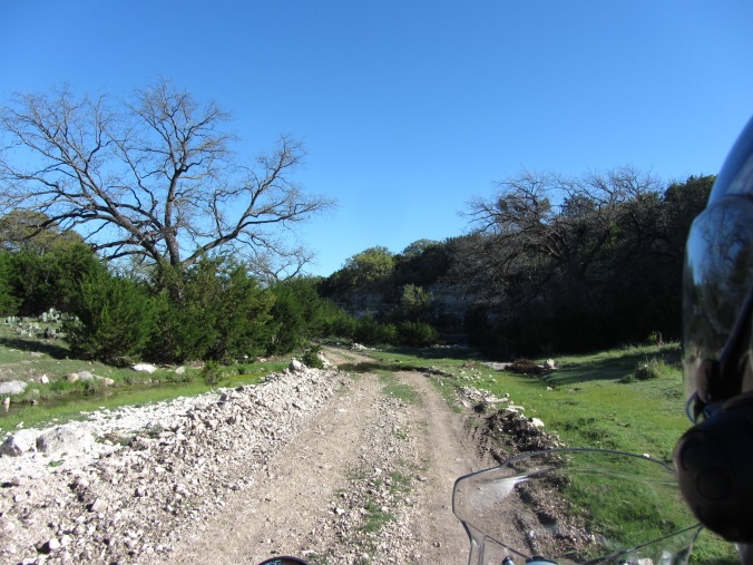
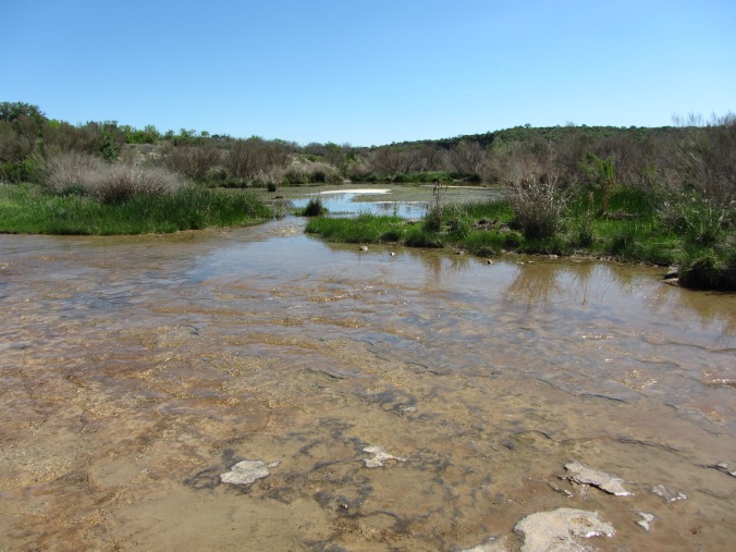
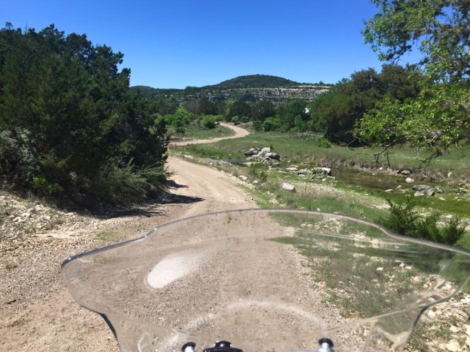
From CR 430 or Mill Creek Rd, we took East Mill Rd and that brought us to our first water crossing of the day, Little Devils River.

IMG_0269

This one didn’t even look like a road, more like the river had removed it.

IMG_4290

So East Mill Rd turns into Salt Branch Road, according to the book. It’s actually Salt Branch Loop so says the mighty GPS and I don’t know if it’s the GPS’s fault or Earl reading the wrong page in the book, but we ended up taking the road that leads to the largest, most difficult water crossing for dual sport riders in all of Texas.

Well, maybe not all of Texas, but the Hill Country for sure.

But before I get to that…

We were riding along on East Mill Road.

IMG_0276

We came to a road that we made a left on when we should have just kept going.

So we’re riding along this road, enjoying the countryside.

IMG_0281IMG_0283

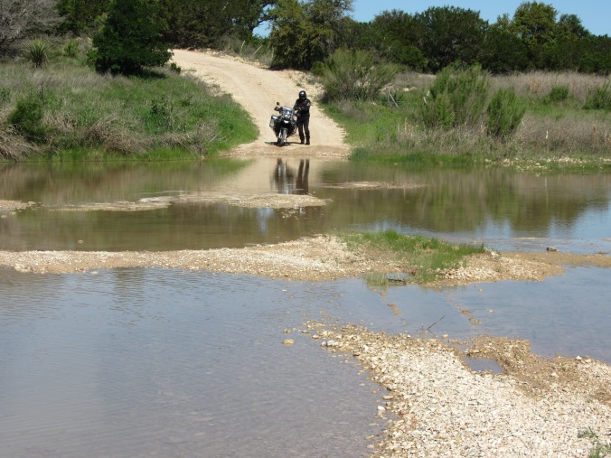
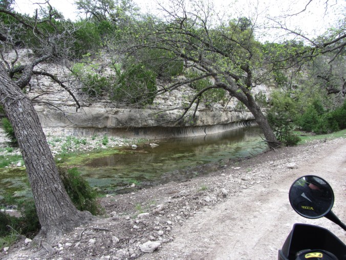
And then we come to our second water crossing of the day.

IMG_0294

This one was rock, not dirt and it was slippery. Very slippery, but we made it across.

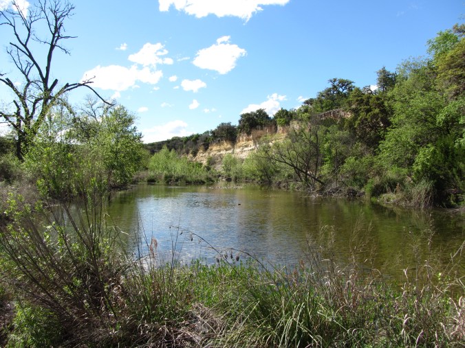
Just past this water crossing I saw a sign that said Eckert James River Bat Cave Preserve and while I was pondering what a bat cave preserve was, an alarm went off in my brain.

James River.

James River Crossing.

Oh shit.

And around the bend, my suspicion was confirmed.

My first thought was Earl came this way intentionally to scare the crap out of me.

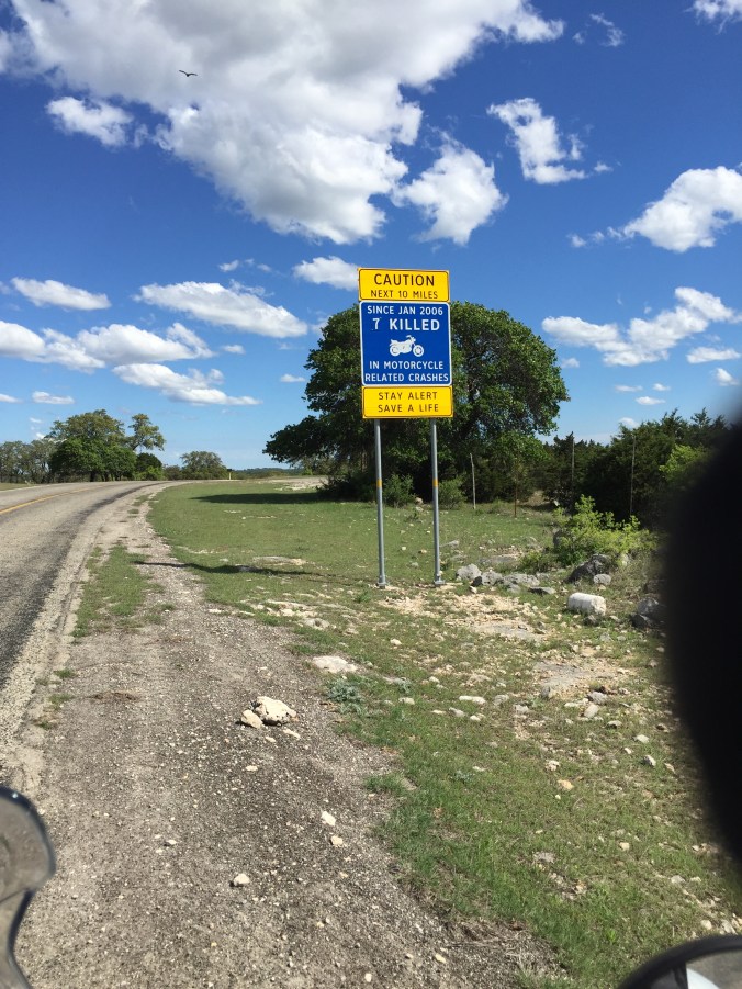
Allow me to mention a billy-goat road in North Carolina where you can hear my not-too-happy voice sprouting profanity on the GoPro video that still makes Earl chuckle to this day.

But that’s not what happened. Innocent mistake, but now what to do?

Crossing was way too risky since we were out there alone, and everything we had with us was loaded onto the bike since we were between motels so the smart thing to do was turn around.

And that’s exactly what we did.

I could have sworn we took a picture of the James River Crossing, but I’ll be damned if I can find it.

So here’s a picture of Earl crossing this one again.

IMG_0295

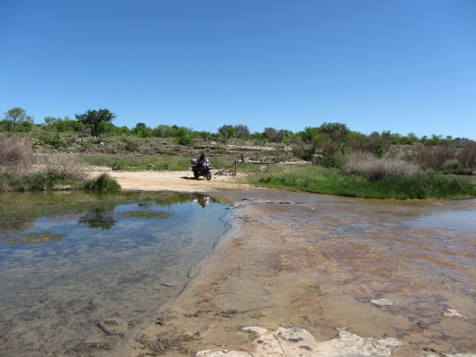
And if it looks slippery driving across, try walking across it. I came very close to busting my ass making my way to the other side to video Earl crossing.

So we got back to the road we were suppose to be on and made our way to Onion Creek Rd.

From there we went south on Hwy 783 to Threadgill Creek Rd.

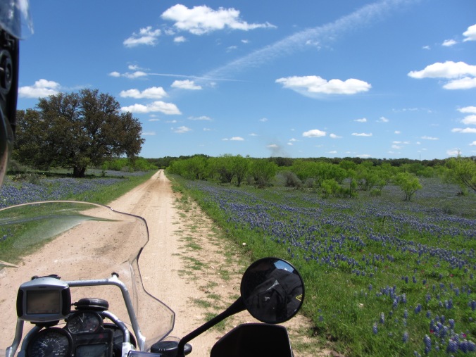
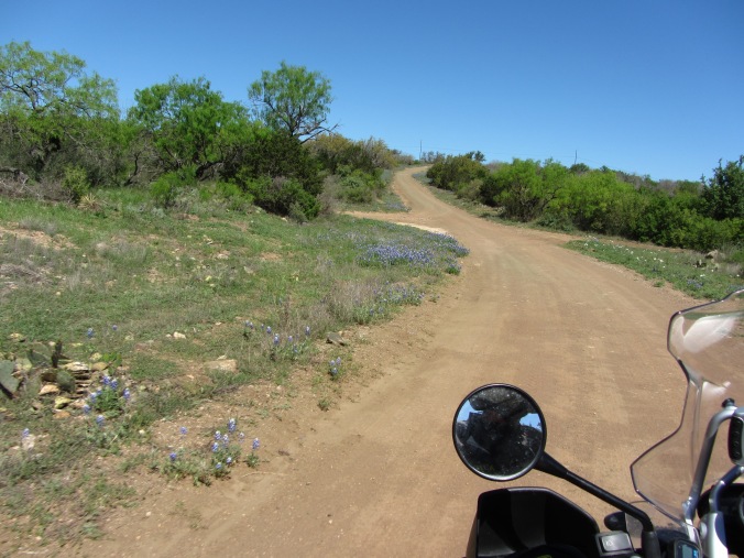
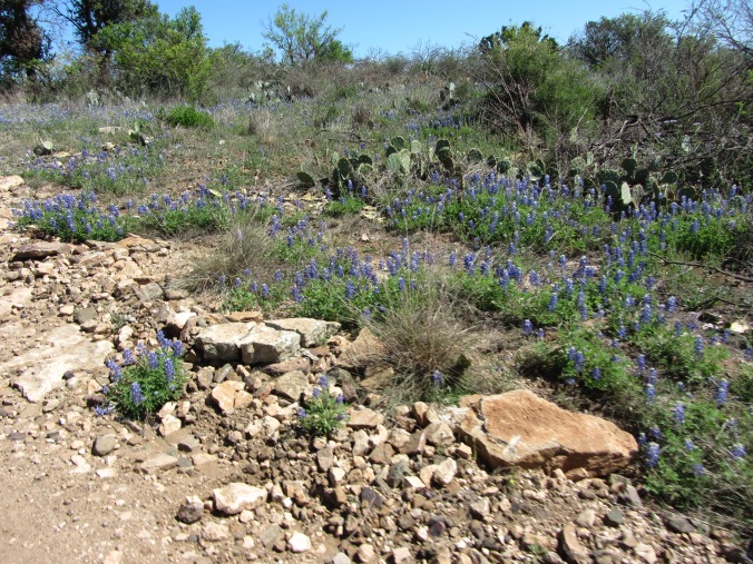
Now I would be leaving out a major detail of the Hill Country in April if I didn’t mention the Blue Bonnets.

IMG_0304

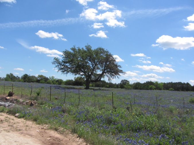
And more Blue Bonnets…

IMG_0326

Lots and lots of Blue Bonnets…

IMG_0330

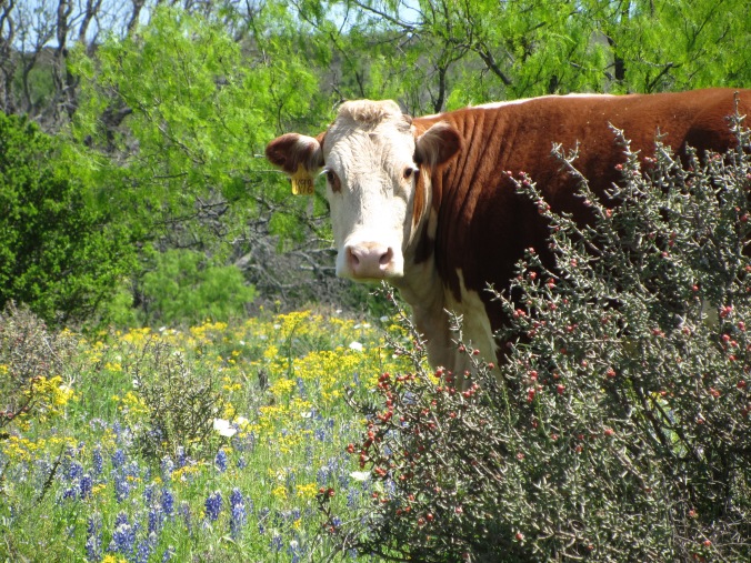
And this photogenic gal…

IMG_0320

Awaiting her close-up amongst the Blue Bonnets…

IMG_0318

From there, it was time to make our way towards Llano and lunch. We hopped on Hwy 2323 north.

IMG_0340

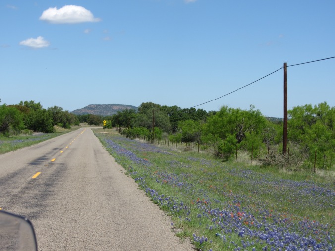
I could see Enchanted Rock in the distance on our way to Llano. We didn’t get to stop to hike it this trip, but that’s just one more excuse to take a bike trip out that way again, not to mention the BBQ.

IMG_3374


Texas Hill Country: Part Two

” Only those who will risk going too far can possibly find out how far one can go.”

-T. S. Eliot 

img_0234

I remember Tuesday morning heading out of Junction, it was cold and cloudy with the hope of clearing and warmth. We had breakfast at the cafe near the motel and loaded up for a day of back road adventures.

Before we left home, we had ordered a book online from a man named Richard Gibbens called “Hill Country Adventure”.  This guy spent a lot of hours riding in the Hill Country and making maps and routes for the motorcycle adventure tourist, and if you ever consider wandering off the beaten path out that way, I highly recommend ordering a copy. ( I’ll add a link at the end of this post)*

We had decided the night before that we were going to combine two different routes from the book into one day’s ride. We only had two days to follow some of the routes before heading eastward to see a friend in Horseshoe Bay.

Ride To Stonehenge II

We took Farm Road 2169 out of Junction. Then CR 410 east to CR 412 south/east.

This took us through heavily wooded, grazing land and also gave us our first encounter with gates. These gates are for keeping property owners critters from running off. The roads are public, but the land on either side of the road is owned by ranchers. It’s also interesting because the live stock runs freely, out into the road if they feel like it. So it’s not a good idea to go tearing through these areas at high speed. Those big horn sheep were out in the road and were in the process of running away when I snapped their picture.

On first approaching the gate, I felt like I was doing something wrong, going somewhere I wasn’t supposed to. But after seeing them a few times, it became no big deal.

When we turned off onto CR 412 it followed along a creek for a little ways and made for nice scenery.

img_0148

What’s really cool about the Hill Country is erosion from wind and water has made some neat geographic features on the landscape. Not as dramatic as the Grand Canyon, but it’s still neat to look at and try to figure out just how it was formed.

From CR 412 we went east on CR 470, then south on  Blue Mountain Road (CR 420) until we got back to pavement on RR 479. Even the paved roads out here offer up nothing less than an eye-catching view.

img_0157

Back on the dirt now, we took CR 443 South to Cr 442 southeast,then CR742 south to HWY 290.

And goats.

Sorry, they were too cute not to share!

Again, we were riding through grazing land so there was a lot of critters to see.

These guys though, I had to stop, get off the bike and say “Hello”and they seemed as equally happy to see us, but I think they may have been hoping for a snack.

We took Hwy 27 southeast into Ingram and from there it gets tricky. Somewhere, we made a wrong turn and completely missed the turn off to see Stonehenge II. It’s a replica of the original Stonehenge in England and we thought it would be a nice spot to sight-see, but we didn’t get to see it that day. I guess we’ll have to ride this route again someday and look for it.

We were far from disappointed with the route though, it was a nice ride.

We found a spot for a pit stop in Ingram and pulled the book out to figure out where to go next.

From Ingram we took Hwy 41 west and heading back towards Leakey and the Three Twisted Sisters.

img_0168


Dual Sport Sisters

The “Dual Sport Sisters” are three dual sport roads that connect with the Three Twisted Sisters.

Try saying that 3 times fast.

We headed west on Hwy 41 back to RR 336 and headed south towards Leakey.


By this time, the sun was coming out and our bellies were growling.

We had passed by a place called Frio Canyon Motorcycle Stop the day before and remembered they had a cafe. So we stopped in for a break and some tasty burgers for lunch. They had a nice little patio out back to sit and eat, and a shop to buy t-shirts and souvenirs.

After lunch, we headed westward on RR 337.

Then we headed north on RR 335 to Bullhead Road, one of the dual sport roads.

img_0212

It’s a nice twisty dirt road through farm land. I didn’t see as many critters on these roads as I had in the morning, but this was a more scenic drive.

img_4284

This was a really cool spot. You can’t really tell how tall this rock face is without the bike in front of it.  As cool as it is, I would imagine during periods of heavy rain this road would be impassable right here.

We continued on Bullhead Road until it dumps you back out onto RR 336.

We headed north to Hwy 41, then went west to Hackberry Road and traveled south.

Hackberry Road is another dual sport sister. The third being Kent Creek Ranch Road that we decided to skip due to it being considered a class 3 (the previous roads we took were class 2). We weren’t sure how that would be riding two-up.

I’m sure if Earl didn’t have me on the back that would have been no problem for him, but an already heavy beast of a motorcycle coupled with the weight of two people is a horrible idea on unfamiliar billy-goat trails.

img_0218

Hackberry Road was another twisty scenic dirt road, but this one has it’s fair share of water crossings.

See that green growth in the picture above?

That is algae.

And that makes some of these concrete water crossings slicker than whale shit. Not too much concern for people with 4 wheels, but on a bike it can get a little hairy.

img_4289

After a few water crossings, farms, and a brief ride along Hackberry Creek, we were back on RR 335 and heading north to Hwy 41 then turned towards the north on Hwy 377.

img_0239

Hwy 377 is a nice twisty road as well.

That took us into Junction and back to the motel for hot showers and ice cold cocktails.

And I have to mention we had dinner at Lum’s BBQ in Junction that night. It’s awesome barbecue inside of a gas station and shouldn’t be missed. The best food in Junction hands down.

We still had one more day to ride the Hill Country before heading east.


*Hill Country Adventure by Richard Gibbens


Texas Hill Country: Part One

“Travel is about the gorgeous feeling of teetering in the unknown” 

img_0283

Back in April of 2015 we made the two day trek,  most of which was on the most boring piece of interstate in the entire United States, to attend the Moto GP race at Circuit of the Americas in Austin, Texas.

After all the race hoopla, we decided to spend a few days riding in the Hill Country and checking out the scenery and some back country dirt roads, and the Hill Country didn’t disappoint. Lots of solitude, lots of water crossings, and lots of cows. Most of the dirt roads went through cattle grazing land, public use of course, but you always had to be on the look out of cows crossing the road!

And let’s not forget about the great curvy roads like the Three Sisters, and small “ma and pa” barbecue joints that dot the Texas countryside.

I decided to post this in sections and try to break it down by which route we took each day. It’s been almost two years since this trip and my memory is a little fuzzy of some the details, but this trip was worth a few blog posts to be sure.


Canyon Lake Dam to Junction

We left Austin on Monday morning and stopped at a Cracker Barrel on l-35 near Buda for breakfast and took back roads to get to Canyon Lake, but since it’s been so long, I’ll be dammed if I can remember which roads we took, though I do remember a small rest area on one road that had chickens running around in the parking lot.

img_0299

So with that said, I’ll start off from Canyon Lake Dam. It’s a nice little stop on the way out to the twisties that has a little park on the water and lets you walk across the top of the dam.

img_0300

From Canyon Lake, we took TX-46 W to TX-16N into Bandera. By then, we were starving and decided to find somewhere to eat. We drove down Main Street and saw a sign that said “Busbee’s Barbecue. As seen on the History Channel”.

Okay. Why not?

Turns out there was a reason why it was on tv. It was pretty good! But I don’t think there’s been very many slow-smoked pork butts I’ve met and didn’t like. Earl had the ribs and brisket, I had pork and sausage. We sampled the lot and were on our way with full, happy bellies.

img_0302

After lunch, we continued on TX-16N on to Medina, then turned westward on to Ranch Road 337. It’s a beautiful stretch of road that winds through mountains. It almost reminded me of roads in western North Carolina. The scenery is different, but no less beautiful.

img_0301

Ranch Road 337 takes you through Leakey, which is the pit stop for riding the Three Sisters. The Three Sisters are made up by Ranch Roads 335, 336, and 337. Our plan was to ride 337, over to 335, then North to head towards Junction, where we were staying for the next few nights. Somewhere, somehow, we drove straight past the turn off for RR 335, and stayed on Hwy 55, till we got to Rocksprings. That wasn’t a terrible road either, just not the right one.

Whoops!

So we gassed-up and re-routed. From Rocksprings, we headed North to Hwy 41, and went westward towards RR 336 instead.

It’s a warm, cozy feeling to see a sign like this:

img_4245

And note the buzzard flying around in the picture.

Are we really sure we want to go this way?

It really wasn’t that bad. It was a fun, scenic country road. There was even a water crossing, no water on it at the time. Just watch for cows!

img_0139

After that fun little detour, we rode North on Hwy 55 again, then onto Hwy 377 into Junction, where we checked in to the motel for the night. It was a fun day on the road, but an even bigger adventure awaited us the following day.