
“What good is livin’ a life you’ve been given, if all you do is stand in one place?” -Lord Huron
Okay. Let me start off by telling you about our accommodations in Hatch, Utah.
 I found this place by using good ol’ Tripadvisor, and it sounded interesting but it really turned out to be a neat spot in an otherwise uneventful small town.
Allow me to introduce “The Galaxy of Hatch”. A small, 7 room roadside motel with attached diner and a biker theme (Harley themed, of course, but that can be forgiven since it’s so well done).
Zion National Park
Anyway, we decided our first full day in Utah should be a trip to Zion National Park to hike The Narrows. This was a priority, so we made sure this was first on the list just in case we became too wrapped up in other “want to do’s”.
I had seen pictures of Zion before and Earl had already been there twice, so I kinda knew what I was in store for, but it still amazed me nonetheless.


After we drove thru the park to the south entrance, we rented water shoes and walking sticks and hopped on a shuttle to the end of the line, after a stop for lunch of course, to Temple Of Sinawava. From there you walk along the river until the sidewalk ends, then you step off into the river and in the river you will stay until you come back out again.
Now I wouldn’t recommend this on a chilly day, maybe if you have a wetsuit. On a hot day in the middle of summer though it was rather refreshing. Oh, and make sure you potty before you go as there’s no bathrooms along this trail nor a private spot for a squat in the bushes.
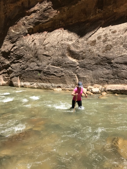
As soon as you try walking in the river, you’ll be glad you rented those shoes and sticks. The water moves fast and the river bottom is nothing but rocks. Without those funky-looking shoes you could very well twist an ankle or worse. And be prepared, you will fall down. At some point you’ll step in a hole since you can’t see where you’re walking or you’ll plant your foot wrong and the fast moving river will not be forgiving.
Now that I’ve given you the “pre-flight”‘ lets enjoy some pictures, shall we?
I’m not sure exactly sure how far we made it up the Narrows, not all the way to Orderville Canyon, but I think we were pretty close. We had been hiking for almost 2 hours and the huge crowd we had been walking with had thinned out to maybe 2 or 3 other groups. It was getting late in the day and we remembered we had to go back the way we came to get out, so it was time to head back.
Of course, on the way back, I was walking along the wall of the canyon using it to help balance through the knee high, fast moving water, then all the sudden, the river bottom disappeared and I was in the water up to my ears! Leave it to me to find the deepest hole in an otherwise shallow part of the river! That was a chilly shuttle ride back!
But that’s ok, because as it turns out Zion Canyon Brewing just happened to be right by the entrance where we parked. There’s something satisfying about a cold glass of suds after a nice hike.
We didn’t get to do the Emerald Pools hike so we’ll have to go back someday and do that, and maybe start earlier in the day to try and go further up the Narrows. It’s a beautiful and fun place, I definitely want to go back with more time to spend there.
Cottonwood Canyon Road
The next morning, we decided to check out the less traveled road and see things your average tourist doesn’t.
It’s a dirt road that starts at the southern end of Grand Staircase-Escalante National Monument that you’d probably pass right on by while driving Hwy 89 unless you were looking for it. It’s in the middle of nowhere, and from the time we got on Cottonwood Canyon Rd to the time we made it to Cannonville, we saw maybe 6 or 7 other cars.

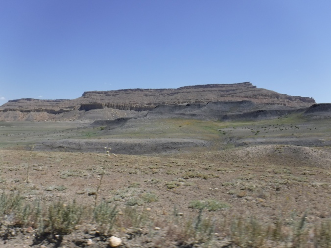

This is one of the most scenic drives there is. I’ve never seen such diverse landscape in such a short period of time in my life. And since there’s literally nothing else around, there is that ominous feeling from time to time, that if you were to have an accident out here, it’d be a long time before anyone found you.
The road follows next to a creek bed that goes through, just as the name says, Cottonwood Canyon.


There’s a few trailheads along the road, and since it was so hot, we pulled in the parking area of one to take a break and drink some water. Figured since we’d taken off our helmets and jackets we’d walk down the trail a little ways. We didn’t get far. The trail went through a small canyon and had a rock slide sometime before so getting through was impossible. But it was a chance to stretch our legs.
Back on the bike and down the road a ways, we come to the top of a hill and behold our view…

Going through this area it started getting sandy in quite a few spots, which makes me nervous riding two-up on an already heavy beast of a motorcycle. It got a little sketchy, but I’m happy to report we remained up-right for the entire ride.
Along this road, there’s a side road that will take you to Grosvenors Arch, but since it was getting past lunch time, we passed on checking it out and kept on trucking.


While riding along, taking in the fantastic views, we came across a Utah traffic jam, complete with cattle dog.

I wish I had taken more pictures of the little guy, he was taking his job very seriously.
Shortly after this we made it into Cannonville and found some lunch, we were starving by this time. After we were done eating it was around 3 o’clock and too late to try and do a whole lot, so we decided we’d head over to Bryce Canyon National Park and take a ride through the park to check it out.
Bryce Canyon National Park
Like I said, it was late in the day, so we drove through the park, stopping at overlooks, and enjoying the ride. It was a nice relaxing afternoon. 


Since we got to Bryce so late, we decided we’d come back the next day and check out some hiking.
The next morning, we came back and drove around in circles in the Sunset Point parking lot about 10 times before finding a parking space. We took off our riding gear and laced up our hiking boots and headed down to do the Navajo and Queens Garden Loop Trails.
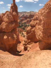
We started by going down Wall Street ( thankfully, because it probably would have required Earl carrying me and someone carrying him for us to get UP Wall Street, as you can see below)


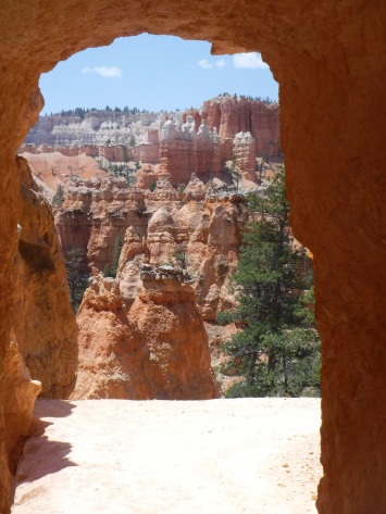
I’m sure I could describe all this to you but, it’s so much easier and eye appealing to let the pictures do the talking here. We spent a few hours wandering among the hoodoos, it was like being on another planet, definitely not something a flat-lander from Florida had ever seen before.
(And just a quick side note, whenever I hear the word “hoodoo” I think of David Bowie singing “Dance Magic Dance” from “Labyrinth”. Your guess is as good as mine.)

“I’m so cute! Gimme your snacks!”
Anyway, back to the hoodoos…

And I’m not really sure where the day went, but we made our way back up to the rim and over to the lodge for lunch. After, we got back on the bike. There was one more place we wanted to see on our last day in Utah.
Red Canyon: Dixie National Forest
Not to backtrack, but on our way back to Hatch from Bryce Canyon the day before we noticed this cool archway right over the road in a place called Red Canyon. I managed to get a picture of it on our way back to Bryce that morning.

So we headed over to the Red Canyon Visitor Center and as it turned out there was trails that started right in the visitor center parking lot.
We didn’t have a whole lot of energy from all the hiking in Bryce, so we picked a quick interpretive hike that went up and around the hill behind the visitors center. It was a nice, relaxing spot away from the crowds at the larger parks.

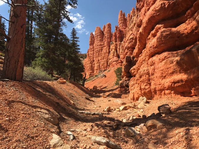

And with that, we wrapped up our last day in Utah. The next morning we were leaving the arid climate of southern Utah for the chilly wilderness of Wyoming.
For more photos from the Utah portion of our trip, check out my video:










You must be logged in to post a comment.